rphyrin's Diary

Recent diary entries

Boiling

Posted by rphyrin on 10 September 2026 in English.

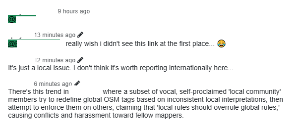
recent hdyc.neis-one.org feature update is really something else. it forces you to read “that thing”. sometimes i accidentally read something that makes my blood boil.

alright, instead of replying there, i’m gonna reply to it here instead.

place=city: The largest settlement within a territory, including national, state and provincial capitals, and other major conurbations (an extended urban area, typically consisting of several towns merging with the suburbs of one or more cities).

place=town: An important urban centre that is larger than a village, smaller than a city, and not a suburb. Towns normally have a good range of shops and facilities which are used by people from nearby villages.

place=village: A smaller distinct settlement, smaller than a town, with few facilities available, with people travelling to nearby towns to access these.

place=hamlet: An isolated settlement.

i can confirm by myself that “that place” is not isolated.

meanwhile, administrative borders should be mapped as ways/relations properly. for a node, just stick with this global consensus definition as stated on the wiki page.

but where can we get that administrative border data?

someone in “that Telegram” group claimed to own all the copyright to this country’s administrative data, even though it is clearly already licensed as open data on “that site”.

i’m not a lawyer, so i don’t know the legality of manually tracing that border from an official source. this is why i hate mapping from official sources. i’d rather stick to local knowledge and direct surveys.

and… that’s it, pretty much.
ivebeen_here

Posted by rphyrin on 9 September 2026 in English.

For ages, I’ve been wanting to tell my stories around a specific place in OSM. Not specifically a “review” of a business, but simply a personal anecdote about me and that particular place.

Years ago, I received my first invitation to give a talk about OSM. On that occasion, I proposed this project: “What if we create a platform where people can share their personal stories around a specific place?”

But I was probably just an “idea guy” back then.

My programming skills weren’t developed enough to build the platform all by myself, and I had no idea how to get funding to pay for a hosting service anyway. So I shelved the idea for a long time.

Fast-forward to 2026, I eventually thought to myself: maybe it’s finally the right time to revisit that old dream.

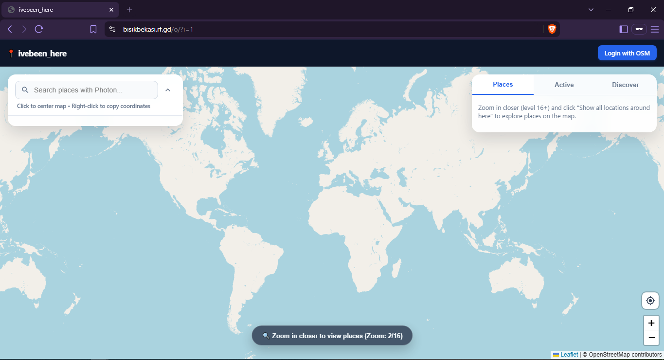
So I built this.

First, you log in using your OSM account.

… See full entry

Tasting the Sourdough

Posted by rphyrin on 1 September 2026 in English.

I’m supposed to write a full report about my attendance at State of the Map 2026. But there are so many materials to discuss, especially the technical ones, and I’m already still stuck on day one already.

If you check my latest OSM Diary entry in my State of the Map 2026 series, you’ll see that my writing stopped rather abruptly at Jake Low’s talk, titled “Sourdough and Layercake.”

It was a very interesting talk. In fact, while watching it live through the Venueless platform, I had already started thinking about some projects that I wanted to build on top of Sourdough.

So instead of continuing to write that report, I started tinkering with Sourdough immediately.

The cool thing about vector maps is that they are so easy to customize on the client side. We can selectively show some data layers and hide the rest. We can emphasize one aspect while pretending that everything else is “not important” and simply not showing it at all. And I think that’s quite a powerful concept.

… See full entry

State of the Map 2026 (Day 1 - Part 2)

Posted by rphyrin on 31 August 2026 in English. Last updated on 3 September 2026.

According to my personal schedule, I was supposed to attend the Guadeloupe room at around 14:50, for a talk titled “State of Panoramax.”

But in reality, the opening speech was still continuing at least until 15:02, and I had to sign out at 15:16.

I managed to finally come back at around 15:56, but by that time, the Guadeloupe room was already empty.

I managed to access the “traces of discussion about the talk” that were still left behind in the Venueless chatbox.

Someone asked this question at 15:21: “Question for Panoramax: What’s your take on privacy. Even with blurring, by having people take photos across a wide time range, AI will be able to deduct when someone was at home, where certain cars were parked and so on, revealing lots of personal info. Is that a good thing that we want to support?”


I have known Panoramax for a long time.

While editing WeeklyOSM’s entries, I frequently received news about their releases and updates. I also happened to learn about updates regarding Baba, a mobile app for contributing to the Panoramax project, because of my activity with WeeklyOSM.

But recently, I finally installed Baba and uploaded photos to Panoramax for the first time, thanks to someone’s suggestion on c.osm.org. I documented the whole train of thought behind this decision in this Mastodon thread.

The real reason was my realization that photographs uploaded through StreetComplete’s note feature are temporary and are going to be deleted soon. I wanted something similar, but permanent. Someone on c.osm.org – I forget who and in which thread – suggested using Panoramax instead. I tried it, and it worked.

Even so, at first, I had quite a hard time finding the right Panoramax instance, because most of them are limited to specific geographic regions, and my country is not listed.

… See full entry

State of the Map 2026 (Day 1 - Part 1)

Posted by rphyrin on 30 August 2026 in English. Last updated on 31 August 2026.

The first time I became aware of the very existence of the “State of the Map” event was, I think, around 2022.

At that time, it was held in Italy. I think I heard about it somewhere online. All I remember is the group photo of the participants (there were plenty of people there) and the beautiful, cool-looking SotM 2022 logo.

That year, I had just recently graduated, so I could get involved in the OpenStreetMap movement more intensely than I had in the years before (before that, I usually only actively mapped during college holiday seasons. Once the holiday was over, I didn’t map anymore). That’s why at that time I started interacting with the community more, and eventually learned about this “State of the Map” event.

Even though I still don’t remember exactly where I first received the news about the event.

At that time, my first reaction was, “I don’t think I’m able to commute farther than either Jakarta or Bandung.” So, back then, I thought, “I don’t think I’m able to visit Italy.”


Fast-forward to after 2022. I gave several technical and/or philosophical talks about OSM sporadically, mostly online. From a technical standpoint, I talked about things like “how to map,” “how to use this particular tool,” or “introducing a tool that I recently built.” From a philosophical standpoint, I talked about ideas and dreams about “how the OSM platform should evolve in the future,” “how we should organize the people in the OSM movement,” etc., etc.

I finally had a chance to attend an OSM-related meeting physically, rather than online, for the first time around 2025. In this case, it was still within the boundaries that I had defined back in 2022 (Jakarta), so I was able to go.

… See full entry

So, how far did i actually cycle today?

Posted by rphyrin on 17 August 2026 in English.

Several weeks ago, my bicycle finally got fixed, after being abandoned in a broken state for a long time.

Before that, I didn’t even know that my bicycle was actually broken.

All I knew was that this bicycle was really, really, really tiring to use. Even a short-distance trip was enough to tire me out for the whole day.

I didn’t know that this was caused by something being broken, which meant I had to put in (approximately) twice the effort to make it move (citation needed).

At that time, I simply blamed my own weak body. “Maybe I’m not strong enough to wield this bicycle,” I thought, dejected, considering giving up my whole cycling career prematurely.

Then, one random day, one of my family members used that bicycle, noticed something wrong with it, fixed it, and then it was finally ridable without needing much energy and force.

Alright. Now I can use my bicycle again, I guess.


For short trips, I usually prefer a bicycle to a motorcycle, for several reasons, you name it : hiking gas prices, the need to reduce our own carbon footprint to save the Earth (back then I took the mandatory environmental college course and thanks to that I’m still brainwashed so hard about the need to reduce my own carbon footprint), a nice opportunity to exercise my body, and the previous trauma of using a motorcycle and then suddenly having the engine not start so I had to walk the motorcycle to the nearest repair shop which turned out to be not near at all. Yeah, plenty of reasons.

So this afternoon, I decided to take a long trip to several places in my town, using my recently fixed bicycle.

I started around 4 PM and went home again around 6 PM.

Now it’s night, I’m sitting in front of my laptop, and getting curious : how many kilometers did I traverse this afternoon while cycling?


I didn’t bring a proper GPS device to record my trip this afternoon, but I remember each path that I took today. So, what should I do to calculate the distance?

At first, I tried BRouter.

… See full entry

Your edits are safe

Posted by rphyrin on 16 August 2026 in English.

One thing that usually worries us as OpenStreetMap mappers is having our hard work deleted by someone else, either accidentally or intentionally.

Thankfully, our edits are still in the database.

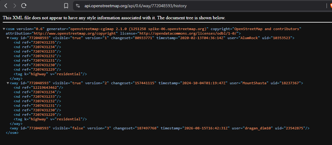
The delete operation in OpenStreetMap is not really a delete operation. It simply flips the object’s visible flag from true to false, while retaining its entire history.

And you can resurrect them using JOSM’s “Undelete Object” feature, as long as you have the OSM object’s ID.

… See full entry

Overpass Ultra

Posted by rphyrin on 5 August 2026 in English.

This afternoon, I noticed that several of my colleagues were visiting a recently opened school in the far south.

They took several photos, which is quite a rarity on the internet, since not many people actually go there and upload pictures of the newly built buildings.

I wanted to upload those photos, hoping they might be useful for anyone trying to find information about the place.

Then I remembered that OpenStreetMap has this image=* tag.

I could associate an image with the place by adding an image URL there. So I opened Vespucci on my Android phone and added the image URL to the object.


Now I’m back at my PC, and I wanted to make a simple app (or maybe just a script) to browse every image=* tag that exists in OpenStreetMap.

At first, I thought of doing it the usual way : build a Leaflet web map, query the Overpass API, then display the images in popups.

But then I remembered that the Overpass API has recently been under heavy load.

From what I’ve heard, it’s because of a barrage of AI scrapers… or maybe just a flood of quick-and-dirty, vibe-coded OSM apps being produced en masse.

Whatever the exact reason, it has noticeably affected the service.

Knowing that, I was discouraged from making the situation any worse. So I scrapped that idea.


Then I remembered something else:

Overpass Ultra.

I don’t know exactly how it works internally, but I assume it uses a different Overpass API endpoint than the ones I would normally query directly.

If that’s the case, perhaps using Ultra wouldn’t add to the current strain on the public Overpass servers.

I also realized that Overpass Ultra’s advanced styling syntax lets me solve the whole problem directly within the query itself, without having to build my own Leaflet-based web app.

So here it is: a quickly put-together Ultra query that displays every OpenStreetMap object containing an image=* tag and shows the referenced image in a simple popup.

… See full entry

"We Prefer Not to Be Mapped"

Posted by rphyrin on 28 July 2026 in English.

One day, in a certain neighborhood, there was a heated discussion about naming an unnamed road.

At first, the discussion was about deciding what name they should choose for the road.

But can you guess the final consensus of that discussion?

They preferred not to be mapped.

The status quo was good enough, they said. The road looked like a maze, with little or no clue on how to properly navigate it. They argued that if they named the unnamed road, it would give “outsiders” a clue on how to navigate it, which was “bad” for the internal security of the people who lived there.

This made me think about the ethical grounds of conducting large-scale mapathon campaigns remotely.

We generally work under the assumption that “the more mapped places, the better.” But what if the locals don’t consent to being mapped?

What if they prefer not to be mapped?

Terjangkau : Neighborhood Explorer

Posted by rphyrin on 15 July 2026 in English.

Today, someone mentioned to me that there’s an ongoing “reform” of a certain local tagging scheme.

At first, I really, really, really, really, really didn’t want to get involved at all.

But in the end, I decided to give it a try and skim the proposal anyway.


After that, I wanted to present an argument.

To support that argument, I wanted to introduce this tool that I made several weeks ago.

But then I realized that I probably never made a blog post announcing it at all.

Weird. Usually, I always make a blog post whenever I finish an app.

After double-checking everything, I think it’s safe to say that I never made a blog post about this app.

Alright. Here we go : https://altilunium.github.io/terjangkau/

… See full entry

Altilunium LocationPad v26.5.22

Posted by rphyrin on 22 May 2026 in English.

That day, I received this email.

19 May 2026 (1:19 PM): We would also like to invite you to a special mapathon as part of the OpenStreetMap Community Building activities in Syria. This activity aims to train participants on using the OpenStreetMap platform and contributing to mapping buildings and roads to support humanitarian work in Syria. Date: 22 May 2026. Time: 11:00 AM (Syria Time). Location: Online (meeting link will be sent after registration).

11:00 AM Syria time is about 3:00 PM in UTC+7.

So, this afternoon, I attended the online meeting.

After that, I joined the mapathon hosted on the HOT Tasking Manager.

Even though, in the presentation, the speaker conducted the mapathon using the iD editor in the browser, this time I preferred to use my set of “powertools”: JOSM, Draw Buildings (B), and LastUpdated.

… See full entry

Altilunium LocationPad v26.5.20

Posted by rphyrin on 20 May 2026 in English.

While preparing this article, I wanted to export the coordinate data of the battlefield map that I created in Altilunium LocationPad to GitHub Gist.

Then, I realized that the exported file format was actually just plain JSON, not proper GeoJSON. That’s why GitHub Gist couldn’t render it as an interactive map.

So, in this version (26.5.20), Altilunium LocationPad now properly exports and imports coordinate data in the proper GeoJSON format.

Image 1 : The exported GeoJSON can now be properly rendered by GitHub Gist.

Every day at around 4 pm (unless there’s IRL business that I have to attend to), I log in to https://osmbc.openstreetmap.de/ to edit this week’s edition of WeeklyOSM.

My task is to review all the links submitted by both WeeklyOSM editors and guest users. I study each link, then write a short sentence describing it.

Some link submitters already accompany their links with proper sentences when submitting, so I mostly skip those. I only focus on links that don’t have English text yet.


This afternoon, while doing my daily WeeklyOSM editing, I stumbled upon this MapComplete post announcing that it is now possible to add pictures to reviews on MapComplete. This feature is powered by Mangrove Reviews.

Then, I suddenly remembered a certain discussion thread on c.osm.org regarding the possibility of building “a crowd-sourced review service for OpenStreetMap.”

… See full entry

Altilunium LocationPad v26.4.6

Posted by rphyrin on 6 April 2026 in English. Last updated on 11 April 2026.

So, I’ve been using Altilunium LocationPad for several of my personal projects until now. But recently, I encountered several problems.

I dabble with multiple projects at once, but this app saves everything in a single database. I want this app to be able to create several separate “canvases”, so I can manage several of my projects at once, without mixing them with other projects.

… See full entry

Yesterday, I attended the OpenStreetMap Local Chapters and Communities Congress 2026 online.

There were at least 15 participants who signed the attendance list on the event’s HackMD document, representing a range of countries including the Philippines, Italy, the United States, Canada, Greece, Indonesia, Belgium, Kenya, and Brazil. The document is available publicly here.

After introductions and updates from the OpenStreetMap Foundation Board, the session moved into a group discussion titled “Challenges in OpenStreetMap and overcoming those challenges.” This discussion was conducted through Mentimeter, allowing participants to submit anonymous responses to guided questions.

Here is a (selected) summary of the discussion results:


Question 1 : If a new mapper asked you “what’s the hardest part about being in the OSM community?” what would you say.

“So many smart people. All with their strong opinions about how things should be done.”

“Dealing with abusive community members.”

… See full entry

Maintainers Working Group #4

Posted by rphyrin on 8 March 2026 in English.

Today I received an invitation to attend the bi-monthly OSM US Maintainers Working Group.

But due to timezone difficulties, I don’t think I’ll be able to attend it live.

The meeting agenda has been shared, mainly focusing on the topic of standards and interoperability. There are some interesting starter questions there, so I’m intrigued to answer those questions in an OSM diary instead, hoping that I’ll be able to join the discussion asynchronously.

So, here we go :


“What standards (geospatial file or data formats, metadata schemas, wire protocols, structured text formats, encodings, etc.) does your project depend on or interact with?”

I frequently use GeoJSON format in several of my projects.

“Are there any standards that you wish would be evolved/extended but aren’t actively maintained? Or implementations that aren’t fully compliant that you wish would be?”

GeoJSON fits pretty much all of my required use cases. My only concern right now is how to make GeoJSON files more compact. I haven’t researched much about this since there’s currently no urgent performance issue that needs to be handled, but I love tweaking my apps for performance.

“Are there standard formats or protocols that you would like to use, but aren’t well supported in your language/ecosystem?”

The General Transit Feed Specification.

I’ve been interested in this data format for a long time, but I still don’t know how to properly tinker with it. Last time I worked on this, I had to make my own Python implementation to read and navigate GTFS files. I don’t know what the current situation is right now. Maybe it’s already supported, maybe not.

“What are your thoughts on Overture’s OGC proposal?”

I already posted my thoughts in a certain Slack thread somewhere. Here’s the verbatim quote:

“Does an OGC standard become legally binding worldwide or something?

… See full entry